ITCZ to bring rains in parts of Luzon, Visayas, Mindanao — Pagasa
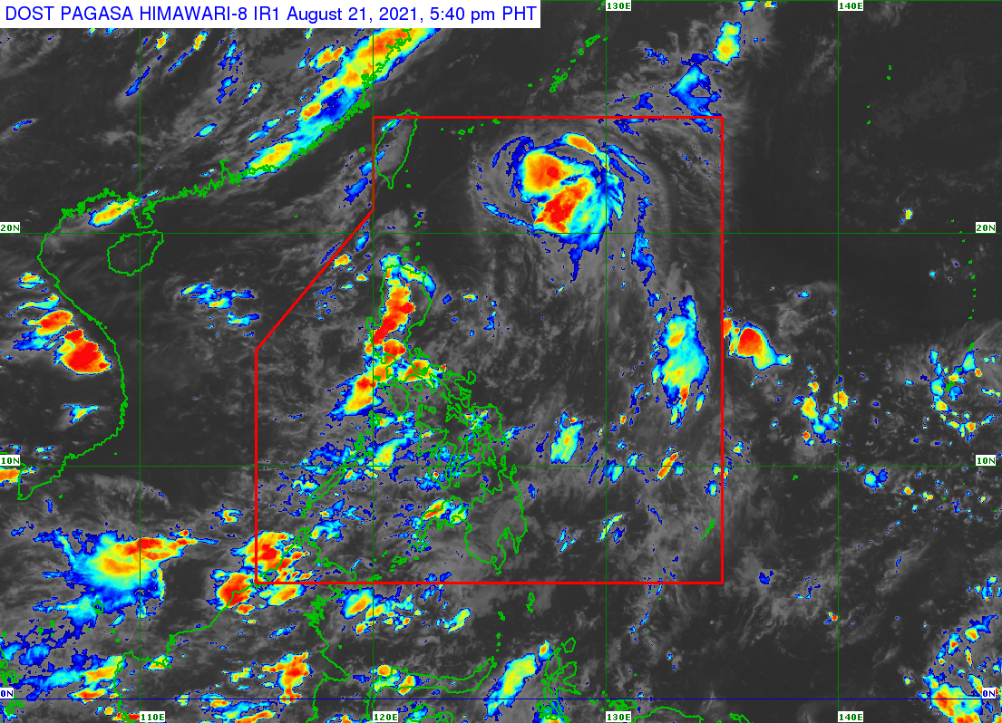
MANILA, Philippines — The intertropical convergence zone (ITCZ) will bring scattered rain showers in parts of Luzon, Visayas, and Mindanao, the Philippine Atmospheric, Geophysical and Astronomical Services Administration (Pagasa) said Saturday afternoon.
ADVERTISEMENT
In its 4 p.m. weather forecast, Pagasa said Metro Manila, Central Luzon, Calabarzon, Mimaropa, Western Visayas, Zamboanga Peninsula, Bangsamoro Autonomous Region in Muslim Mindanao, and Soccsksargen will have cloudy skies with scattered rain showers and thunderstorms due to the ITCZ.
The rest of the country will have partly cloudy to cloudy skies with isolated rain showers or thunderstorms either due to the ITCZ or localized thunderstorms, according to the state weather service.
LP’s possible 2022 Senate bets: De Lima, Pangilinan, Hontiveros, Diokno, Aquino
No need for quarantine pass in NCR under MECQ – MMC
At present, the ITCZ continues to affect Southern Luzon, the Visayas, and Mindanao, said Pagasa. An ITCZ is where winds coming from the northern and southern hemispheres converge, bringing clouds that cause rains.
Meanwhile, in a tropical cyclone bulletin issued at 5 p.m., Pagasa said Tropical Storm Isang continues to intensify as it crosses the Philippine Sea east of extreme Northern Luzon.
The center of Isang was last spotted 585 kilometers east-northeast of Itbayat, Batanes. The tropical cyclone is packing maximum sustained winds of 85 kilometers per hour (kph) near the center and gusts of up to 105 kph and is moving northwestward at 15 kph.
No tropical cyclone wind signal (TCWS) is currently raised in the country.
Pagasa said Isang is unlikely to affect the weather and bring heavy rainfall. The hosting of TCWS is also unlikely.
Isang will remain far from the country’s landmass, according to Pagasa. It is expected to move generally northwestward this Saturday until Sunday morning and turn north-northwestward on Sunday afternoon over the East China Sea. It will then move northward on early Monday morning and north-northeastward in the afternoon.
Isang is forecast to exit the Philippine area of responsibility (PAR) on Sunday morning or afternoon.
ADVERTISEMENT
“This tropical storm is forecast to intensify into a severe tropical storm tonight or tomorrow early morning, after which it is likely to reach its peak intensity. A weakening trend may commence by Monday morning,” Pagasa said.
RELATED STORIES
Pagasa: Fair Saturday weather nationwide
Pagasa says Isang intensifies, now a tropical storm
/MUF
Subscribe to our daily newsletter
Click
here
for more weather related news.
Read Next
Gov’t, private sector urged to upgrade online education infra amid pandemic
EDITORS’ PICK
MOST READ
Don’t miss out on the latest news and information.
View comments


