
TD Caloy keeps strength; to exit PAR within 24 hours, says Pagasa
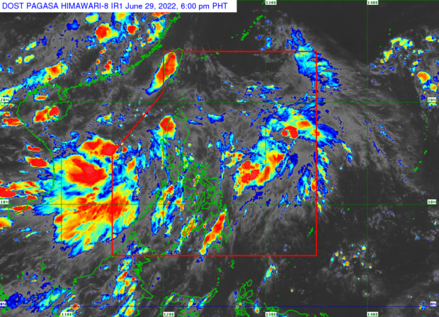
Weather satellite image from Pagasa’s website
MANILA, Philippines — Tropical Depression Caloy continues to hover over the West Philippine Sea, strengthening the southwest monsoon or “habagat,” the state weather bureau said.
The Philippine Atmospheric, Geophysical and Astronomical Services Administration (Pagasa) noted in its latest forecast that Caloy was spotted 390 kilometers (km) west of Iba, Zambales, on Wednesday afternoon, and slowly moving north-northwest with maximum wind speeds of 45 km per hour (kph) and gusts of up to 55 kph.
ADVERTISEMENT
Pagasa weather specialist Chris Perez said Caloy is expected to reach the tropical storm category on Friday, July 1, but it may have already left the Philippine Area of Responsibility (PAR) by then as Caloy is seen to exit the country within 24 hours.
“Malayo ang bagyong si Caloy at wala itong direktang epekto sa ating bansa, wala pong nakataas na warning signal sa ano mang bahagi ng ating bansa,” he said.
SEC has ordered Rappler shutdown, says CEO Ressa
Solo parents get P1,000 monthly, more perks under new law
Sara Duterte won’t see Robredo before June 30; plans to have lunch with ex-VPs
(TD Caloy is far away and it has no direct effect on our country, there is no raised warning signal in any part of our country.)
“Subalit ‘yung pinagibayong (But the reinforced) habagat or southwest monsoon will bring occasionally gusty conditions reaching strong breeze-to-near gale in strength over Extreme Northern Luzon and the western sections of Luzon and Visayas,” he added.
Due to this, Perez said moderate to heavy rains could be expected over Palawan, Oriental Mindoro, Occidental Mindoro, Zambales, Bataan, Cavite, Batangas, and Laguna.
He also said that light to moderate, to at times heavy rain may also be expected over Metro Manila, Romblon, Marinduque, Rizal, Tarlac, Pampanga, Aurora, Quezon, Ilocos Region, Bicol Region, and Western Visayas.
Both the tropical depression and southwest monsoon were likewise anticipated to cause moderate to rough sea conditions in the seaboards of Northern Luzon and the western seaboard of Central and Southern Luzon, according to Pagasa.
Wave as high as 1.2 to 3.4 meters is possible, Pagasa added.
New LPA likely
Perez then warned that another low-pressure area (LPA) may form near the eastern part of Luzon.
ADVERTISEMENT
“Kanina sa satellite animation nakita ang makapal na kumpol ng kaulapan sa Silangangang Luzon, we’re not ruling out the possibility na may posibleng mabuong LPA doon, within the next 24 to 48 hours,” he said.
(Earlier in the satellite animation we saw a thick cluster of clouds in Eastern Luzon, we’re not ruling out the possibility that there will be a possible LPA there, within the next 24 to 48 hours.)
RELATED STORIES
Pagasa: TD Caloy ‘almost stationary’ over West Philippine Sea
Tropical Depression Caloy enhances habagat; rains expected across PH
KGA
Subscribe to our daily newsletter
Click here for more weather related news.
Read Next
Another 12 bills lapse into law as Duterte ends Presidential term
EDITORS’ PICK
MOST READ
Don’t miss out on the latest news and information. 

View comments