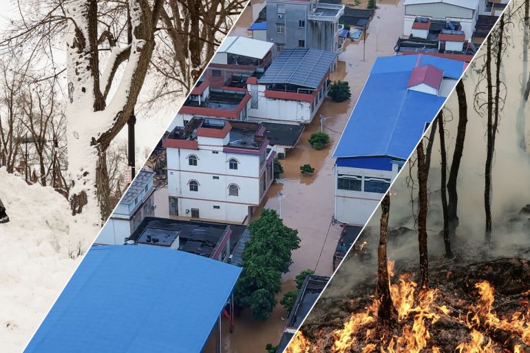
El Nino reaches super status: Where will it bring rain, drought and heat?
Forecasters say the Pacific Ocean warming pattern could be the strongest on record. Here is what that means for you.


15 Sep 2026
A powerful El Nino is taking shape in the Pacific, and it is reshaping weather across the globe.
El Nino is a natural climate pattern caused by warmer-than-usual water in the central and eastern Pacific.
Data from the United States National Oceanic and Atmospheric Administration (NOAA), released on September 14, 2026, shows El Nino has breached the temperature rise threshold of 2C (3.6F), thus becoming “very strong”, informally known as a super El Nino.
This year’s El Nino began developing in June 2026 and is expected to peak by early 2027, with forecasters warning it could be one of the strongest ever recorded. NOAA’s Climate Prediction Center expects it to persist through March-May 2027.
According to the World Meteorological Organization (WMO), El Nino happens every two to seven years. It usually starts between March and June, peaks between November and February, and can last up to 18 months.

How could El Nino affect your country?
A very strong El Nino tends to bring heavier rain to East Africa, South America and the southern US, drought to South Asia, Southeast Asia, Australia and Southern Africa, as well as warmer temperatures almost everywhere.
Select your country from the dropdown below to see where rainfall is likely to increase or decrease.
Where could it rain more?
El Nino typically brings heavier rain to East Africa, South America and the southern US.
East Africa is expecting heavier rain than usual between October and December. The IGAD Climate Prediction and Applications Centre, based in Ngong, Kenya, puts the chance of wetter conditions in southern Ethiopia, central and southern Somalia, and northeastern Kenya at 90 percent. These rains can supply up to 70 percent of the region’s annual rainfall, so heavier rain also means a higher risk of flooding.

El Nino typically brings more rain to parts of South America and the southern US too, with wetter conditions expected along the coasts of Ecuador and northern Peru in early 2027, then spreading to southern Brazil, Uruguay and northeastern Argentina between September 2026 and January 2027.
Where could it turn drier?
El Nino typically brings drier conditions to South Asia, Southeast Asia, Australia and Southern Africa.
India and Pakistan’s summer monsoon has fallen short. Rainfall across India was 15 percent below average between June 1 and September 9, according to the India Meteorological Department.
Indonesia faces a drier season and higher wildfire risk. Its meteorological agency, BMKG, recorded 5,019 hotspots by late July, with Sumatra and Kalimantan at the highest risk.

Australia’s Bureau of Meteorology expects below-average rainfall across southern and eastern parts, with warmer temperatures raising the risk of wildfires.
The South African Weather Service expects below-normal rainfall and above-normal temperatures across most of the country through spring and summer.
How could El Nino affect food supplies?
The World Food Programme (WFP) warns that El Nino could push at least 49 million more people into acute hunger by the end of 2027.
That would raise the total across the 45 countries it analysed from 225 million to 274 million. Eastern and Southern Africa and Latin America face the largest increases.
The United Nations Food and Agriculture Organization says maize, rice and other rain-fed crops are most at risk. Dry conditions threaten harvests from Southern Africa and the Sahel to South and Southeast Asia.
“El Nino is a massive threat to the food security of millions who are already vulnerable,” said Carl Skau, WFP’s acting executive director.

Will El Nino make it hotter?
Yes. The phenomenon usually warms the planet, with the biggest effect felt the year after it develops.
The WMO expects warmer-than-normal temperatures almost everywhere from September to November. It also sees an 86 percent chance that at least one year between now and 2030 beats 2024 as the hottest on record.
“There is an El Nino predicted for the end of 2026, which increases the chances of the following year, 2027, being the next record-breaking year,” said Leon Hermanson, who led the forecast.
What about snow?
El Nino’s biggest effect on North American winters comes through the jet stream – the fast, high-altitude winds that steer storms.
During El Nino, the strongest part of this jet shifts south and stretches farther east, pushing storms across the southern third of the continent.
NOAA scientists call El Nino “the great snowfall suppressor” for most of the continent.
In past El Nino winters, snowfall dropped below average around the Great Lakes, interior New England, the northern Rockies, the Pacific Northwest, western Canada and Alaska. The southern US, especially at higher elevations, tended to get more.

NOAA notes these are past patterns, not a forecast, and can vary widely year to year.
The link is weaker in Europe. The United Kingdom’s Met Office expects a higher chance of wetter, stormier conditions in Northwest Europe this autumn and early winter, while the European Centre for Medium-Range Weather Forecasts has linked El Nino to colder late winters in Northern Europe.
What else could change?
A strong El Nino usually calms the Atlantic hurricane season. NOAA’s August outlook gave a 75 percent chance of a below-normal season, noting that every strong event in recent history has been linked to below-average activity.

Forecasters stress that no two El Nino events are alike. The WMO warns that the strength of an event does not translate directly into the scale of its impacts in any single region, since conditions in the Indian and Atlantic oceans also play a role.
“El Nino is being supersized before our eyes,” UN Secretary-General Antonio Guterres said in a WMO statement. “The science leaves no room for doubt: the planet is in uncharted waters, and those waters are heating up.”