
Trough of Maring, ITCZ to bring rain in Bicol, Visayas, Mindanao
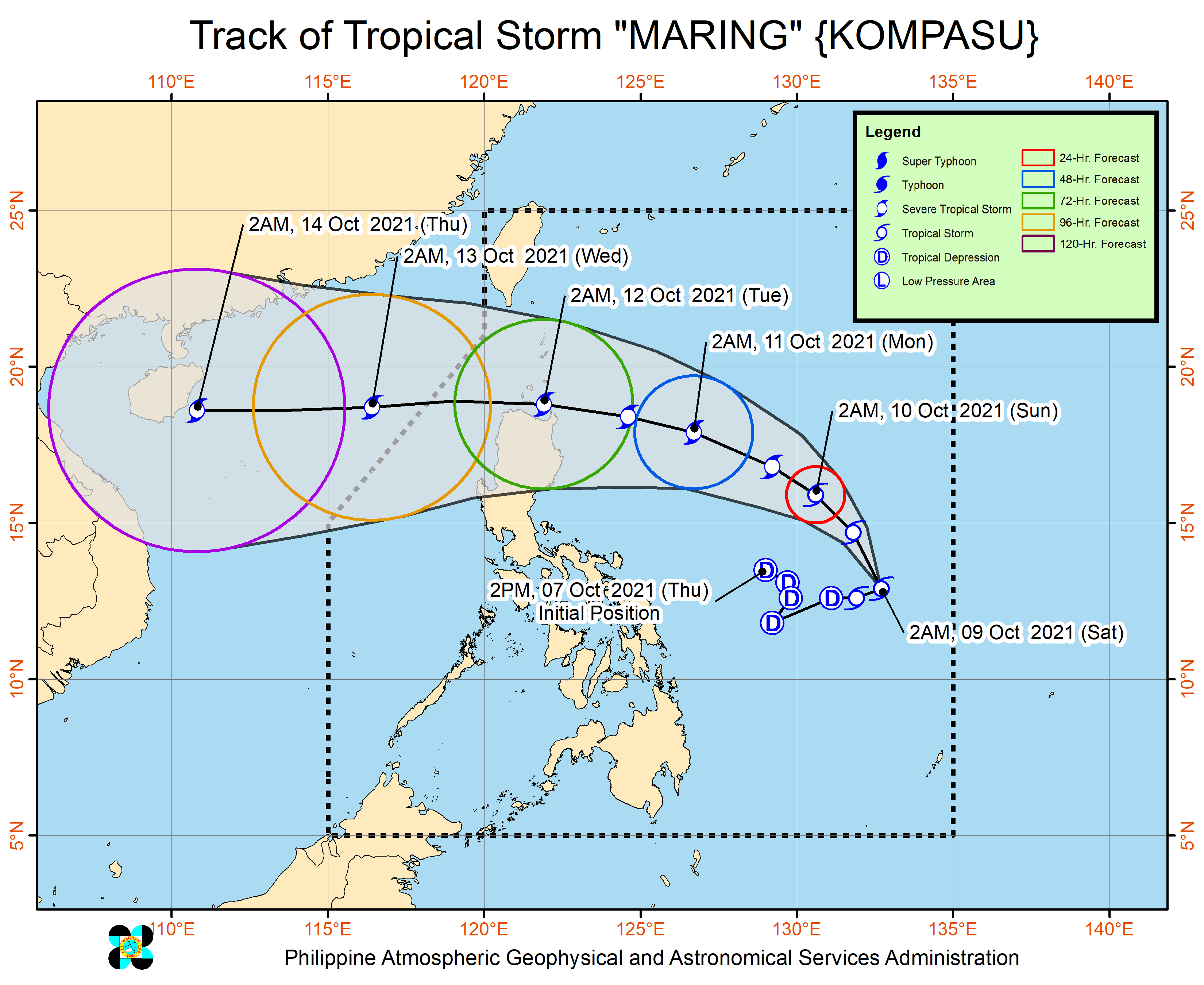
Track of Tropical Storm Maring. Image from Pagasa
MANILA, Philippines — Visayas, Mindanao, and the Bicol Region will have cloudy skies with scattered rain showers and thunderstorms due to the trough of tropical storm Maring and the intertropical convergence zone (ITCZ), the Philippine Atmospheric, Geophysical, and Astronomical Services Administration (Pagasa) said Saturday.
Meanwhile, Metro Manila and the rest of Luzon will have partly cloudy to cloudy skies with isolated rain showers due to the ITCZ and localized thunderstorms, based on the weather forecast of Pagasa.
ADVERTISEMENT
Pagasa said the center of tropical storm Maring was last located 875 kilometers east of Catarman, Northern Samar. It added that Maring has further intensified and remains a large tropical cyclone.
Moving 15 kilometers per hour towards tropical depression Nando, Maring is packing maximum sustained winds of 85 kph near the center and gustiness of up to 105 kph.
In a separate bulletin for Maring, Pagasa said moderate to heavy rains are also possible over Eastern Visayas and Dinagat Islands, while light to moderate with at times heavy rains are possible over Bicol Region and the rest of Visayas and Caraga.
“Beginning this afternoon or evening, light to moderate with at times heavy rains may also begin affecting Palawan and Occidental Mindoro as the southwesterlies enhanced by ‘Maring’ begin affecting these areas,” the weather bureau said.
Pagasa warned that under these conditions, isolated to scattered flooding, including flash floods, and rain-induced landslides are possible especially in areas that are highly or very highly susceptible to these hazards.
Tropical Cyclone Wind Signal (TCWS) No. 1 will likely be hoisted for some localities in Northern Luzon beginning Saturday or Sunday in anticipation of the arrival of strong breeze to near gale conditions with higher gusts. The highest possible wind signal for Maring remains at TCWS No. 2.
Pagasa said a “near-term erratic movement remains likely in the next 24 hours as the circulations of both ‘Maring’ and ‘Nando’ interact with each other in a potential merger event.”
Tropical depression Nando was last located 1,105 km east of Northern Luzon. Moving westward at 25 kph, it is packing maximum sustained winds of 55 kph near the center and gustiness of 70 kph.
However, Pagasa said Nando is unlikely to directly affect the weather condition in the country throughout its forecast period.
Subscribe to our daily newsletter
Click
here
for more weather related news.
Read Next
CHR chairman Chito Gascon dies in bout with COVID-19
EDITORS’ PICK
MOST READ
Don’t miss out on the latest news and information.


View comments